Elevation: 1846 masl
Difficulty Level: 3/10 (minor climb)
Hike Duration: 7-9 hrs
Location: Ampucao, Itogon Benguet
The weather is cold again—it’s that time of the year to hit the mountains! For my first hike this 2025, I’m heading to the famous Mt. Ulap in Itogon, Benguet. It is a popular hiking destination known for its breathtaking ridge views, scenic pine forests, and sea of clouds. Perfect for beginners and seasoned hikers alike, this trail offers a mix of adventure and serenity, making it an iconic spot in the Cordillera region.
I hiked Mt. Ulap on January 26, 2025, as a day hike. Since I was going solo, I joined a group tour organized by Cris Travellers. I chose them because they offered a pick-up service in Cavite, which was convenient since I was coming from Indang. I contacted them and availed of their day hike package to Mt. Ulap, which cost ₱1,799. They required a ₱500 down payment to reserve a slot.
The meet-up with the group was scheduled for the evening of January 25. However, there were some issues, like the vehicle breaking down, so we didn’t leave Cavite until 12midnight. We stopped at a diner in Pangasinan to have breakfast. On the way to the jump-off, we had another delay when the vehicle got a flat tire, which pushed our schedule back even further.

The jump-off point was at Ampucao Elementary School, where each group was given an orientation by a tour guide before starting the hike. We finally began at 8:30 AM, with the sun already up and blazing.

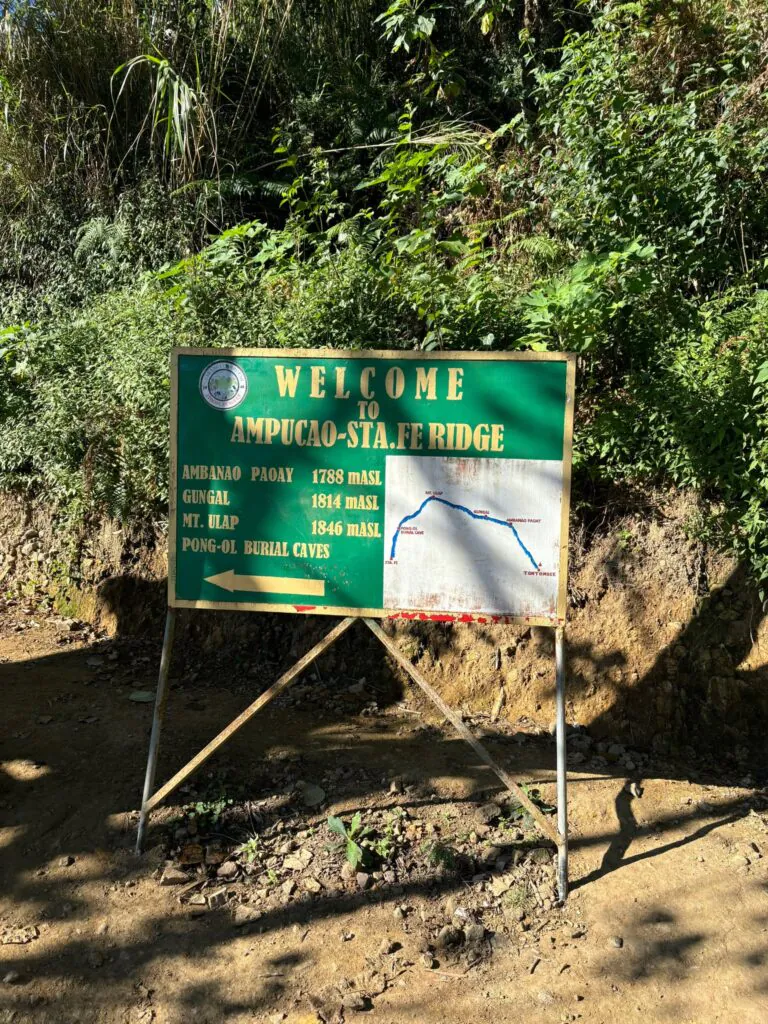
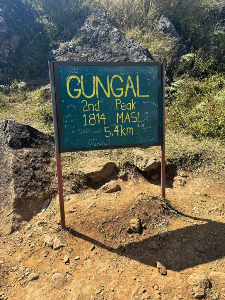
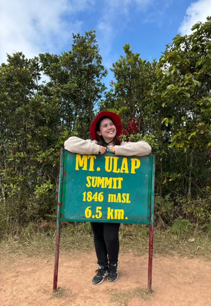
During the orientation, it was explained that the trail consists of three peaks. The first is Ambanao Paoay, standing at 1,788 meters above sea level (masl) and 3.6 kilometers from the jump-off. Next is Gungal, the most popular spot for photo-taking, at 1,814 masl and 5.4 kilometers from the jump-off. Finally, the Mt. Ulap summit stands at 1,846 masl and is 6.5 kilometers from the starting point. The descent is an additional 2.6 kilometers, making the entire hike a total of 9.1 kilometers.
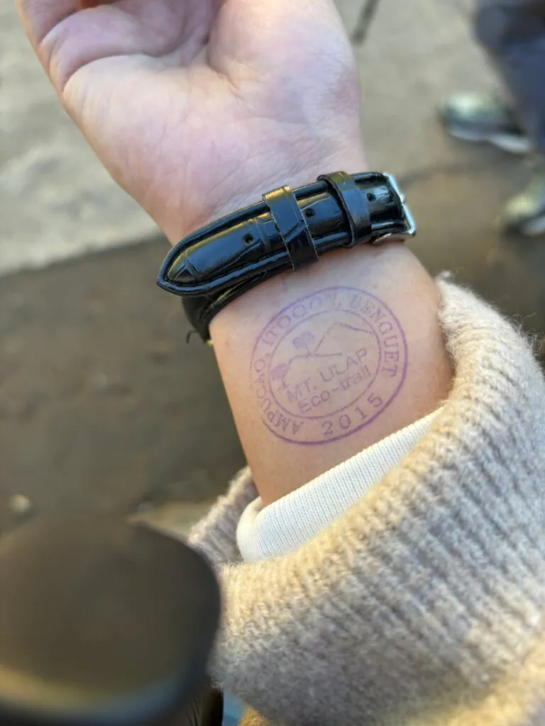
Hikers will have their wrists stamped before starting the trek. The hike begins with an uphill cemented curve, and right from the start, you’ll already feel out of breath. The initial stretch is a long, steep incline. Honestly, I initially thought this mountain would mostly have flat terrain, but I was completely wrong.
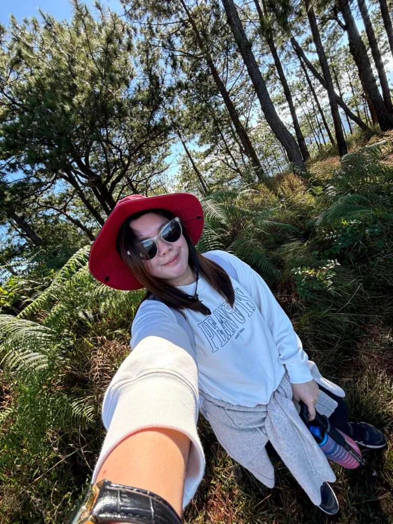
Thankfully, even though it was already hot, the cool breeze felt refreshing—it really helped cool you down. Along the trail, there were spots with stunning views that were already photo-worthy, making the hike even more enjoyable.

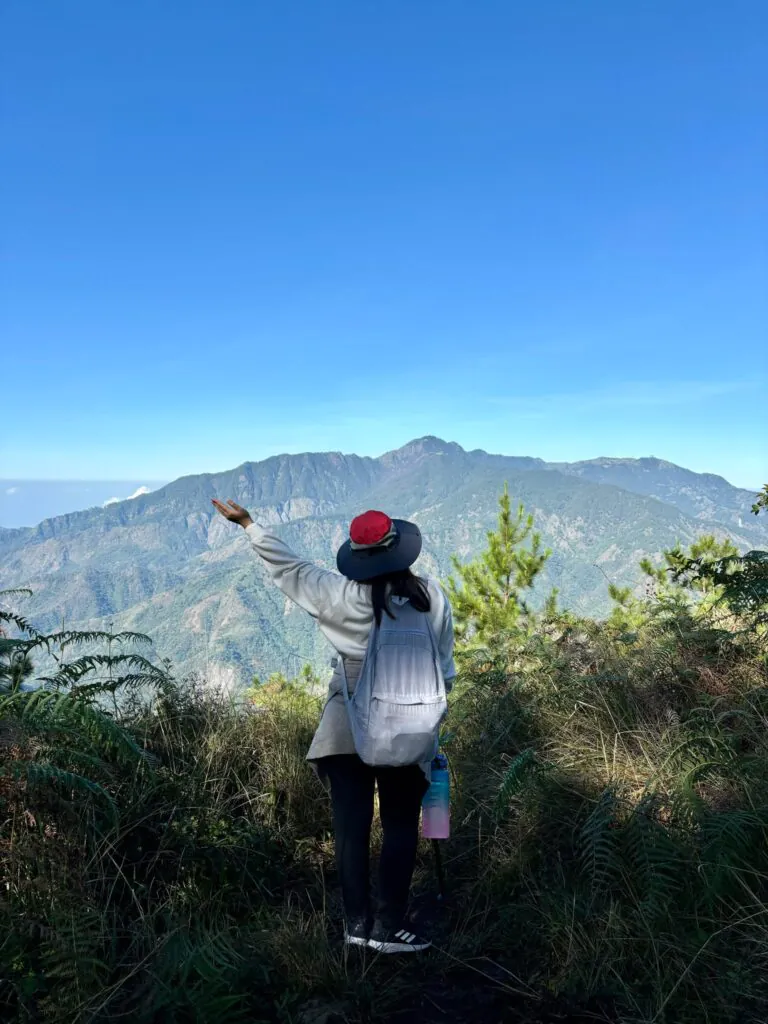
We reached the first peak around 10:45 AM. We took some pictures at the sign and spent some time appreciating the view. It was actually a good thing that we started a bit late because there were hardly any other hikers on the trail by then—most of them had already moved ahead. It made it easier to take photos without any rush.

We continued hiking, and I highly recommend bringing a trekking pole because the uphill sections were really challenging. By the way, there are vendors at the jump-off area selling trekking poles, caps, jackets, and other hiking essentials. However, I suggest buying these items online instead—they’re much cheaper.
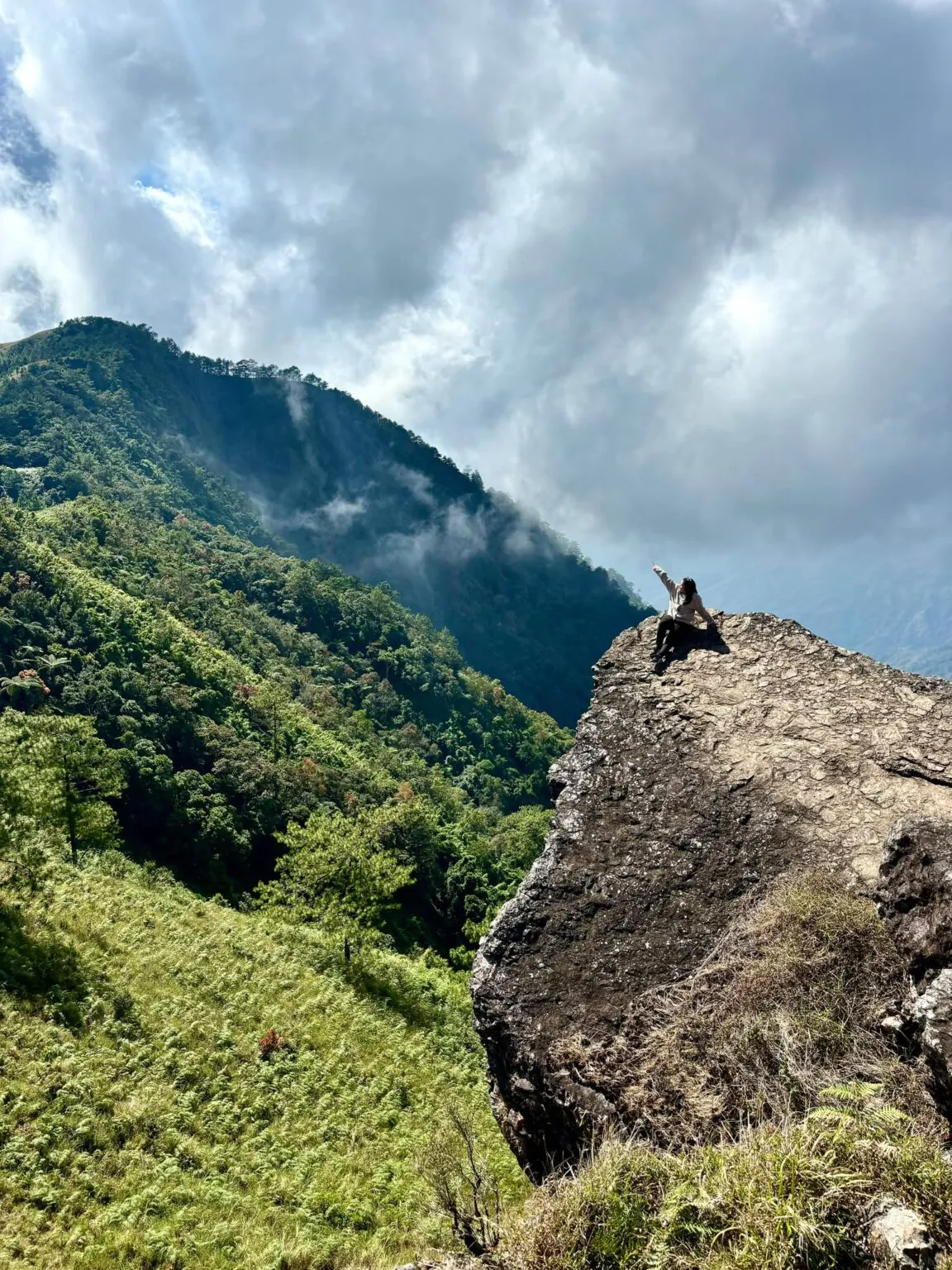
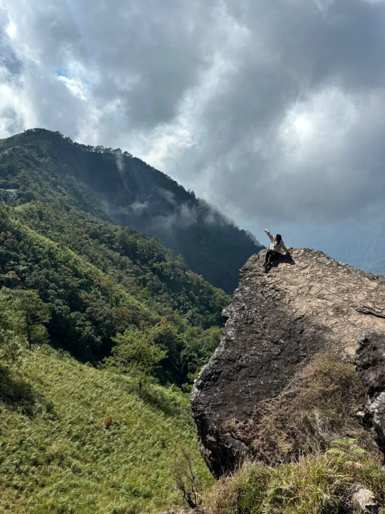
We reached the second peak, Gungal, around 1 PM. This is the spot where most hikers line up because it’s the famous photo spot that serves as a trademark for climbing Mt. Ulap. Each person is allowed only 10 seconds for pictures. We waited for about an hour for our turn.
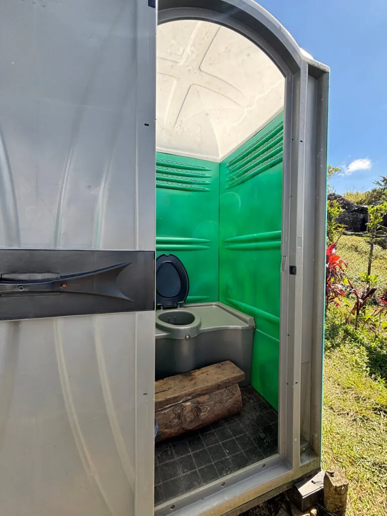
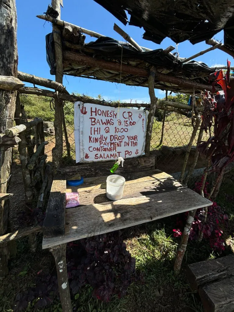
There’s a portable toilet available in this area for ₱10.
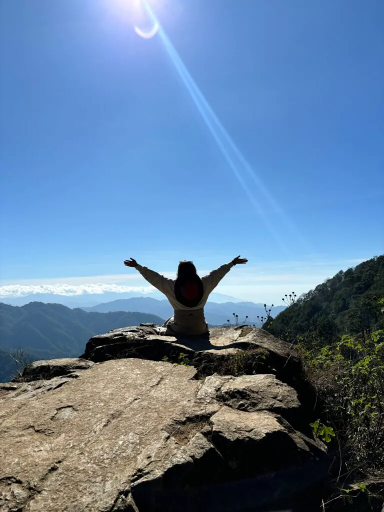
The hike was really tough, even though I wasn’t a first-timer, and it felt like the trail was longer than expected. We reached the Mt. Ulap summit around 2:30 PM, completely exhausted and hungry since we hadn’t had lunch yet. But the place was absolutely beautiful, and it was so fulfilling to finally reach the summit, despite how challenging the trail was.
There’s a canteen about 10-15 minutes from the summit, where we had lunch and took a break after our photo op at the top. The canteen also sells souvenirs. Along the way, we passed by some cows since the area is a grazing land for them. Be careful while walking though, as there’s a lot of cow dung along the path.
We started our descent around 3:15 PM after resting. If the ascent was hard, the descent was even more challenging. You really need a trekking pole because the trail is extremely steep. Even though there are some wooden stairs, the ground is very rocky and slippery, so you have to be extra careful to avoid slipping and falling. It’s important that your knees are in good condition since you’ll really need to rely on them. The first 1 km was all rocky and dirt paths, then after about 8 km, we reached the cemented stairs, which were about 1 km long. It was incredibly exhausting. On the way down, there are some hanging bridges to cross as you get closer to the end. We finally made it down around 5:30 PM. There’s a shower area at the base where you can freshen up after the tiring hike.
Here are some tips for hiking Mt. Ulap:
- Pack light to avoid unnecessary weight.
- Bring plenty of water to stay hydrated.
- A trekking pole is highly recommended for easier navigation, especially on steep trails.
- Don’t forget to apply sunblock to protect your skin from the sun.
- Wear a cap and sunglasses for added protection from the sun.
- Comfortable footwear is a must for a long hike.
- Always do a warm-up before starting the hike to avoid injuries.
- Bring extra money (₱10 for using the comfort room, ₱50 for the shower).
- Bring light snacks like nuts, jellyace, and chocolates for energy along the way.
- Take time to capture the beauty of nature around you.
- Enjoy the hike and the experience!
I thought Mt. Ulap would be easy, but I feel like it’s more challenging than Mt. Pulag. I really struggled on this hike, or maybe it was because we started late, and the heat of the sun added to the exhaustion. But I assure you, it’s worth the pain and the challenge. It’s tough, but the beauty makes it all worth it. Try Mt. Ulap, and let me know about your experience!